| |
 |
|
| ▲ Gunsan Oreum |
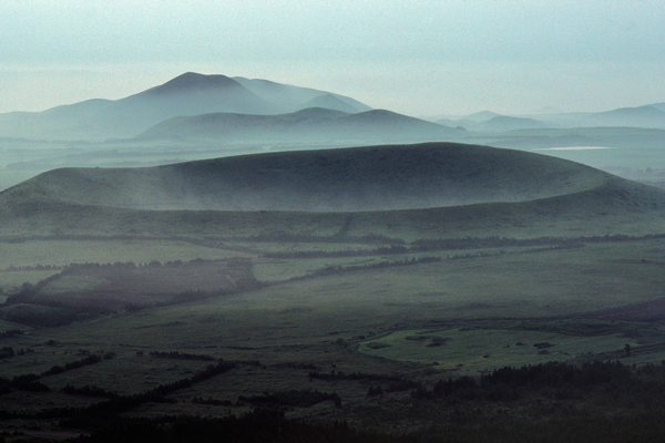
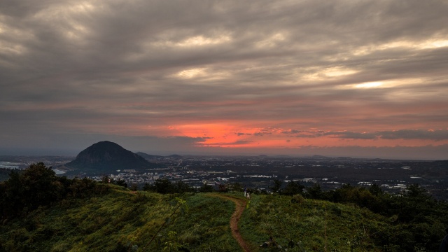
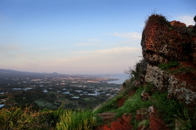
The administrative address for this area is Yerae-dong, Seogwipo-si, Jeju-do. Yerae-dong is located to the left of the Jungmun Tourist Complex, filled with five-star hotels. The character “ye” means lion, and “rae” means to come; thus, it is “a village where a lion comes.” I wondered what the backstory was, and it became clear once I climbed up the oreum to the north of the town, standing tall like screens. It’s called Gunsan Oreum, the protective mountain of Yerae-dong.
About 335m above sea level, Gunsan is known for its unique features. There is no gumburi at the top. Gumburi is a Jeju word that refers to volcanic craters. Instead of one, there is a grassy plateau and one peak each in the east and the west. This suggests that the eruption was not very active. An oreum with a pointed peak is called a sut-oreum (a “male” oreum), and an oreum with a flat or concave one is called an am-oreum (a “female” oreum). Naturally, there are far more am-oreum in Jeju. Gunsan is one of the few sut-oreum in the island. Some assert the two peaks on each side resemble military barracks, hence the name “Gunsan (military mountain),” but it hasn’t been verified. Others interpret “gun” as the prefix that means “unnecessarily added.” If this is correct, it would make this oreum an additionally formed hill.
| |
 |
|
| ▲ Gunsan Oreum |
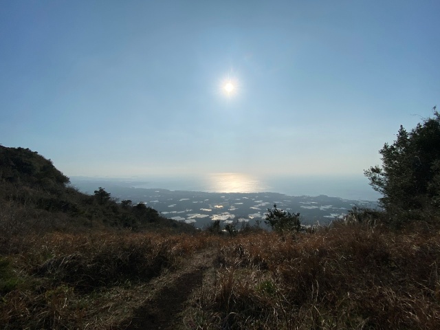
Now, let’s climb to the top. Gunsan boasts one of the best sceneries out of Jeju’s 368 volcanic peaks. It literally shows you the 360-degree panoramic view of southwestern Jeju. You could probably see about a quarter of the island at a glance.
In other words, you can overlook everything on the ground. Towards the east, there’s a hazy sight of Beomseom Island off the Seogwipo shores. That’s where a myth originated. Beomseom, or an island that resembles a tiger, coincidentally stares right at Yerae-dong. The tiger island’s gaze stops at this lion town. Back in the day, the Yerae-dong area had always been cursed by the tiger and bore the brunt of that misfortune. Gunsan rose up behind the village about 1,000 years ago, and ever since, it has found peace. It’s because the oreum was in the shape of a lion.
After hearing this myth, the oreum with two peaks on the sides looks like a lion. Also, at the eastern foot of Gunsan, there is a protruding boulder. It’s called Lion Rock. The lush bushes behind the rock resemble a male lion’s mane. According to the myth, the village is safe because it sits under a mountain and a rock that look like a lion. It’s rare to find towns like Yerae-dong that have a name that matches their myth. Once you stand atop the Gunsan Oreum, you can see how the expansive southern foot embraces Yerae-dong.
Gunsan Oreum has an explicit record of its volcanic activities. According to Goryeosa, during the 10th year of King Mokjong’s reign (1007), Gunsan Oreum was formed due to a volcanic eruption. Back then, it was named Seosan, which means “an auspicious mountain.” Numerous stories have originated from the oreum, perhaps because of this blessed beginning.
| |
 |
|
| ▲ Gunsan Oreum |
The myth of geumjangji (land prohibited as gravesite) is one of them. The crest of the oreum is mostly grassy, aside from the two peaks. It’s a wide plateau area. You don’t need to know anything about fengshui to recognize how propitious it is. The view is fantastic, and the two peaks protect it from above. However, it is prohibited as a burial site. When the dead are buried here, it leads to draughts. The village suffered a harsh drought when someone buried their family here secretly. It only rained after everyone in the town searched the area for the grave and relocated it. That’s why the oreum’s foot is filled with graves surrounded by stone walls, but none in the top area.
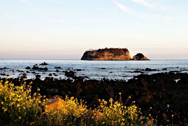
Gunsan is also one of the youngest oreum in Jeju. Because it’s only about 1,000 years old, it has great geological value. It allows us to study the most recent geological features of Jeju. If you bring a compass to the peak on the right, it malfunctions because the soil is different from other oreum. Because of the iron content in the soil, the needle in the compass dances at the peaks of Gunsan and Gogeunsan in Seogwipo among Jeju’s oreum. From the top of Gunsan, Beomseom Island appears when you look at the eastern sea.
| |
 |
|
| ▲ Beomseom Island |
Beomseom Island also appears constantly in Jeju’s myths and history. One such example is when Seolmundae Halmang sits atop Gogeunsan Mountain and paddles her feet in the water. Historically, in the 23rd year of King Gongmin of Goryeo (1374), Beomseom was the last battleground of the Rebellion of Mokho.
Mokho, also called hachi (hapjeok), were expert horse breeders. After the Goryeo-Mongolian War ended and the remaining Sambyeolcho rebels that fled to Jeju were suppressed, Yuan installed Tamna prefectures in Jeju Island. They established a ranch to raise horses for the expedition to Japan, sending a group of handlers called mokho to manage them.
When Goryeo established diplomatic relations with the Ming dynasty in 1370 instead of the Yuan, the court ordered to send the Jeju horses to Ming. The Rebellion of Mokho erupted against this decision and were later suppressed. |


